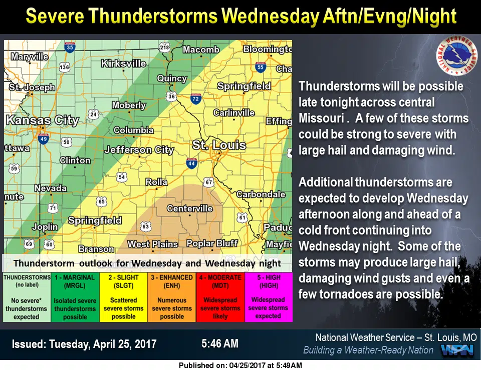
We’ll have one more warm and dry day today. But, then some severe storms could be on the way for Wednesday and Wednesday night.
The National Weather Service in St. Louis says that an unsettled weather pattern is on the horizon, but one more warm day is on tap before the stormy pattern takes shape. Tuesday will feature above average temperatures with gradually increasing clouds and highs in the upper 70s to lower 80s. A slow-moving cold front will then impact the area bringing showers and thunderstorms Tuesday night through Wednesday night. Isolated severe thunderstorms will be possible across central Missouri on Tuesday night, with a greater threat of strong to severe thunderstorms Wednesday and Wednesday night. Another slow-moving storm system will then impact the region again Friday through the weekend bringing showers and thunderstorms, along with the potential of heavy rain and some severe weather as well.