


A major winter storm is on the way to the area on Sunday.
The latest forecast shows snow beginning in our area in the early Sunday morning hours. Then, snow and freezing rain on Sunday, possibly mixing with sleet, with a high of 26 on Sunday. It will be windy as east winds will gust better than 25 miles per hour on Sunday. Ice accumulation of .1 to .2 of an inch are possible and snow and sleet accumulation of 3 to 5 inches during the day on Sunday. Snow will continue Sunday night with a low of 19. And, additional snow accumulation of 3 to 5 inches is possible on Sunday night. The snow would then taper off on Monday morning with a high of just 23 on Monday.
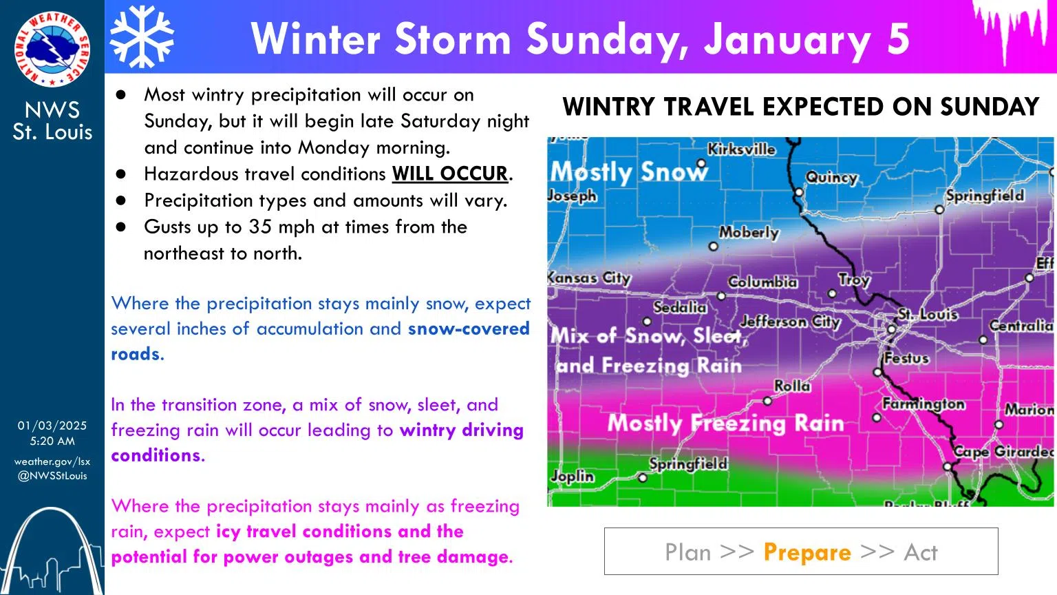
In their latest Weather Briefing, the National Weather Service in St. Louis says wintry precipitation is expected. There is very high confidence that wintry precipitation will impact the entire forecast area. The bulk of this precipitation will fall on Sunday, though precipitation could begin as early as late Saturday night and continue into Monday morning. Travel impacts are expected area wide. They also add there is still some uncertainty with a few things. The NWS says there will be a transition from freezing rain to sleet to snow that occurs across our region. Where this transition occurs is uncertain and may even change over the course of the storm. More significant winter weather impacts including power outages and higher end (10+) snowfall totals are possible. Total precipitation amounts
with this system have increased. However, these higher amounts are only possible in areas that stay the same precipitation type through much of the storm.
As for snow total amounts from the storm, the NWS estimates there’s a 91% chance of at least 4 inches of snow, an 80% chance of 6 inches and a 62% chance of 8 inches of snow.


")
Comments