


It will be sunny, windy & warm today.
We are looking at sunny skies for today with a high of 68. Winds from the southwest will gust better than 20 miles per hour today. Then, we’ll see mostly clear skies for tonight with a low of 37.
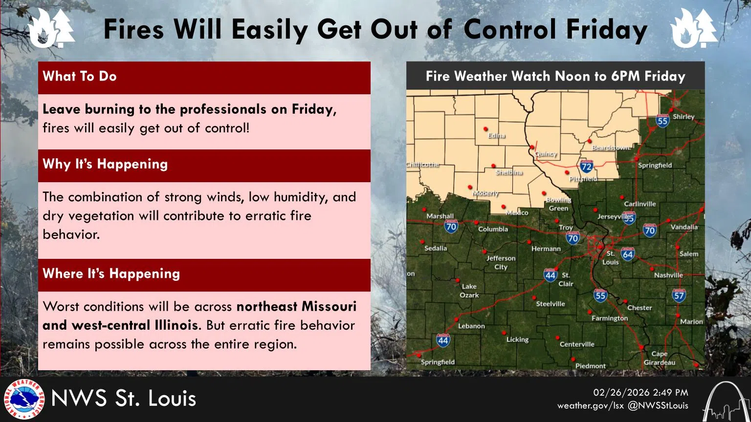
Meanwhile, with today’s conditions our area is under an Elevated Fire Danger for Today. The National Weather Service in St. Louis says fires will easily get out of control today, leaving burning to the professionals! Dry and windy conditions will create erratic fire conditions across the region today.
Meanwhile, after another warm day on Saturday, we will see a cold front move into the area on Sunday and bring wintry weather on Sunday night and into Monday. In their latest Weather Briefing the NWS says after a few warm days late this week, a strong cold front will bring much colder air back to the region this weekend. They add that confidence is high in wintry precipitation Sunday into Monday, though they say the location of highest impacts are still not known. They do add the warm prefrontal air may mitigate impacts outside of where the heaviest precipitation falls.
We remain in the transition zone with all snow off to our north and all rain well off to our south.
As for our actual forecast for Sunday night, it says rain and snow–becoming all snow early Monday morning–with a low of 29. New snow accumulation of 1 to 2 inches possible. Then, Monday would be a chance of rain and snow in the morning—then a slight chance of rain after that—with a high of 42.


Comments