


Severe storms are set to hit the area this afternoon.
Our forecast for today calls for showers and thunderstorms are likely with a high of 85. Winds from the south will gust better than 30 miles per hour today. Then, we have a chance of showers and storms for tonight with a low of 56.
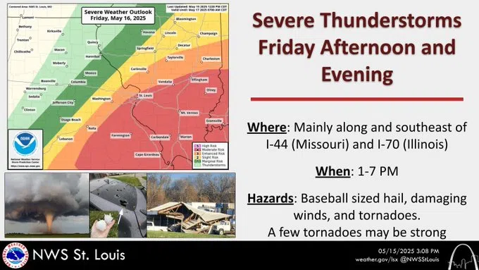
In their latest weather briefing, the National Weather Service in St. Louis says severe storms are expected to develop around 1 PM over east-central, and south central to southeast Missouri, generally from just west of the St. Louis Metro Area to along and east of I-44. Storms will move quickly east-northeast, exiting south central Illinois by 6-7 PM. Very large 2+ inch hail and 80+ mph winds are the primary threats this afternoon. A few tornadoes are also possible and they may be strong (EF2+). As for the time period, the latest map shows the storms arriving in our area between 3 pm and 5 pm today and exiting the area between 4 pm and 7 pm. The NWS adds in their weather briefing that Confidence is high that severe thunderstorms will be able to develop within a moist and very unstable air mass this afternoon.


Comments