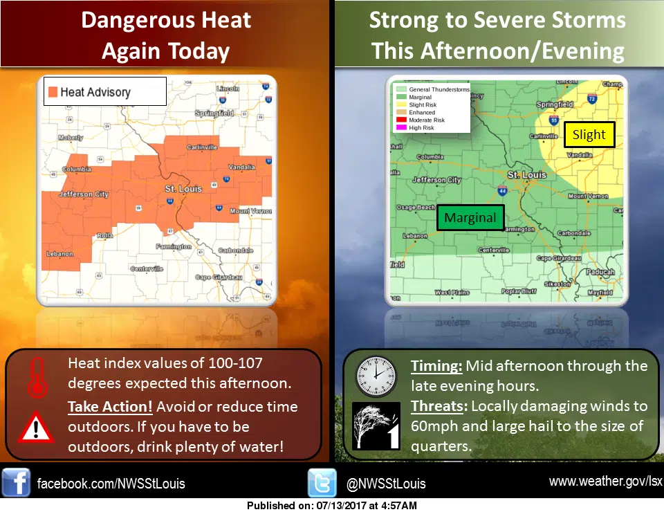
It could be a sticky and stormy day around the area. After several days of heat and humidity, we are seeing our hottest day of the week today. The National Weather Service in St. Louis has now included our area under a Heat Advisory that will remain in effect until 7 pm. We’ll see a high today of 94 with heat index readings as high as 106 for today.
Meanwhile, a cold front will approach the area this afternoon and into this evening, helping to spark showers and thunderstorms. The National Weather Service says a few of these storms may be strong to locally severe with the primary threats being winds up to 60 miles per hour and quarter sized hail. Our area is in the “slight” risk area for severe storms this afternoon and into tonight.