The Flash Flood Watch continues for
* portions of Illinois and Missouri…including the following
counties…in Illinois…Bond IL…Calhoun IL…Clinton IL…
Fayette IL…Greene IL…Jersey IL…Macoupin IL…Madison
IL…Marion IL…Monroe IL…Montgomery IL…Randolph IL…
Saint Clair IL and Washington IL. In Missouri…Audrain MO…
Boone MO…Callaway MO…Cole MO…Crawford MO…Franklin MO…
Gasconade MO…Iron MO…Jefferson MO…Lincoln MO…Madison
MO…Moniteau MO…Montgomery MO…Osage MO…Pike MO…
Reynolds MO…Saint Charles MO…Saint Francois MO…Saint
Louis City MO…Saint Louis MO…Sainte Genevieve MO…Warren
MO and Washington MO.
* from this evening through late Sunday night
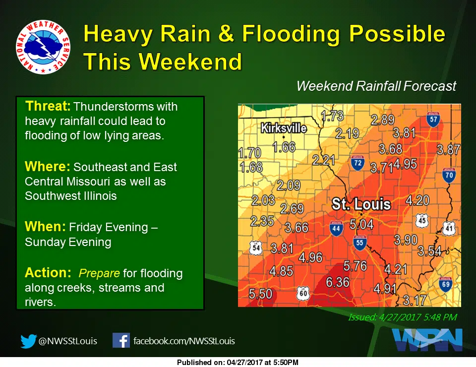
* Recent rainfall has set the stage for a significant flooding
event this weekend. A slow moving and potent storm system will
interact with a very moist airmass to produce heavy rainfall
over the weekend. Rainfall totals of 3 to 5 inches are likely
with locally higher amounts possible across southeastern
Missouri and southern Illinois.
* Heavy rainfall will result in flooding of low lying or poor
drainage areas…and ultimately dangerous flash flooding on
smaller creeks and streams. Moderate to major flooding is also
possible on larger streams and rivers.