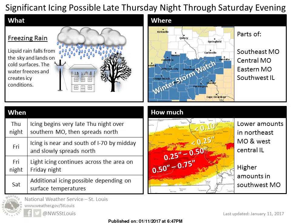
A cold, wintry, icy and potentially dangerous weather begins to set hold over the area later today. Fayette County is now included in the Winter Storm Watch, which is in effect from Friday afternoon thru Sunday afternoon. For today, showers and thunderstorms are a possibility and we’ll see temperatures fall during the day today into the mid 30s. For tonight, we are looking at partly cloudy skies with a low of 24. For tomorrow, there is a chance of freezing rain and sleet during the day, changing over to all freezing rain in the evening with a high of 33. Friday night there is a chance of freezing rain with a low of 30. For Saturday, there is a chance of freezing rain in the morning and then a chance of rain after that with a high of 36. Saturday night there is again a chance of freezing rain with a low of 30. And, then a chance of freezing rain in the morning on Sunday, changing over to rain as we’ll see a high on Sunday of 38.
As for the Winter Storm Watch, the National Weather Service in St. Louis says freezing rain is expected to start Friday afternoon, and periods of freezing rain will likely continue thru Sunday with accumulation possibilities of one-quarter to one-half inch of ice. This will certainly make road travel difficult, also making all area parking lots an issue. And, the ice could lead to downed tree limbs or the possibility of downed power lines.