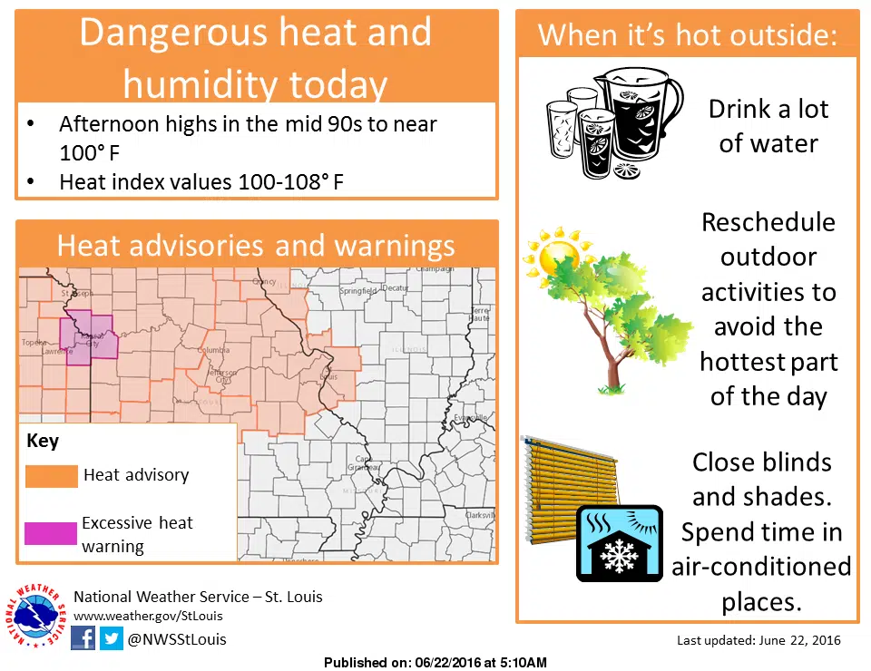
In a period of hot and humid weather over the past couple of weeks, we are probably looking at our worst day so far today. We are looking at high today of 95 and heat index readings as high as 101 for this afternoon. Areas in St. Louis and the metro east are under a heat advisory but we have stayed just below that level—as we have not been under a heat advisory at all during this hot spell. Meanwhile, there is a chance of some showers and thunderstorms for today and a few of the storms have the potential to be severe with the primary threat being damaging wind gusts and large hail. Areas just to our north are under a Severe Thunderstorm Watch this morning—but those storms have stayed to the north of Fayette County. Meanwhile, To add to the extreme heat of today will be the fact that we really won’t cool down tonight. The expected low for tonight is 78—and then back over 90 on Thursday.