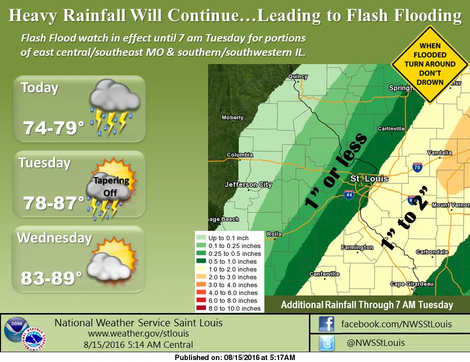
We are looking at another day filled with rain throughout the area. A Flash Flood Watch remains in effect until 7 am Tuesday morning for the entire area. Showers and thunderstorms will be ongoing for today and are likely for tonight, with some heavy rain at times, with a high today of 76 and a low tonight of 68. The National Weather Service in St. Louis says rain is expected to become heavy at times across the region thru tonight, with the highest rainfall amounts expected thru this afternoon. The NWS says that an additional 1 to 3 inches with locally higher amounts is expected.
Meanwhile, after the rain moves on—probably sometime tonight or early Tuesday morning—we are going to be looking at fairly mild temperatures for mid-August. Tuesday we have a chance of showers and storms with a high of 80 and then mostly sunny skies on Wednesday with a high of 84.